I’m an ecologist and GIS professional interested in using spatial data to advance a just and sustainable future. I am currently a Nearshore Ecologist at the Washington State Department of Natural Resources, where I use GIS to study kelp forest spatial dynamics in Washington waters to support effective stewardship of these critical habitats. I was recently a Dangermond Fellow at the National Audubon Society, leveraging Enterprise GIS to advance bird conservation across the Americas. Prior to that, I spent 3 years as the GIS lead for a small team of marine restoration ecologists at Puget Sound Restoration Fund. You can see a few of my public projects here.

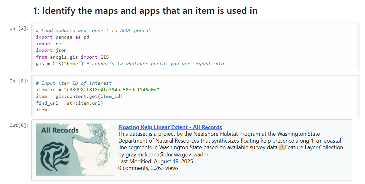
Statewide Kelp Forest Data Synthesis

Mapping Seattle's Historical Kelp Forests
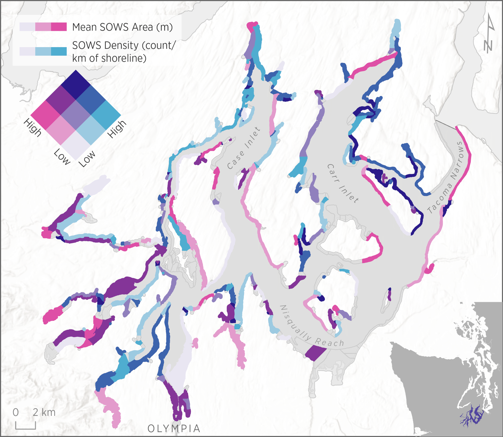
Small Overwater Structures Analysis

Audubon Cartography Guide

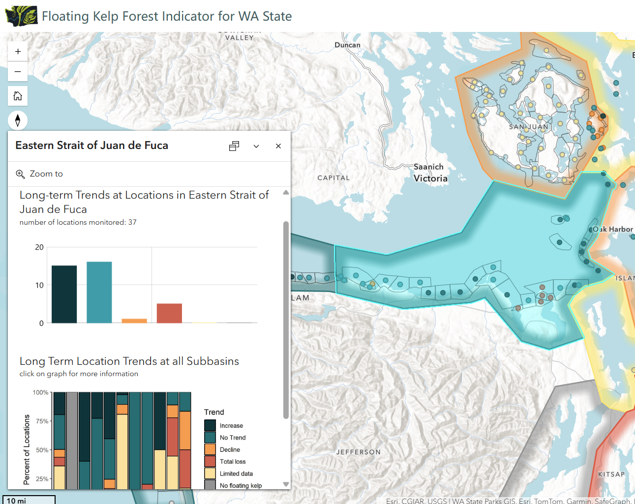
Kelp Forest Status Map

Bull Kelp Restoration Site Selection Tool

Forest Decision Support Tool

Hiking Mt. Storm King
Managing ArcGIS Web Content

Cartography Club: Retro
Experience Builder Migration

Olympia Oyster Restoration in Hood Canal

Maps for Coastal Policy Advocacy

Olympia Oyster Restoration StoryMap

Birds Connect NYC & Columbia

Shrub-Steppe Habitat Loss

Enterprise GIS Newsletter

Field Maps Quick Guide

Kelp Diagrams and Illustrations
For more examples of my cartographic work, including maps for technical reports and permit applications, please contact me directly.