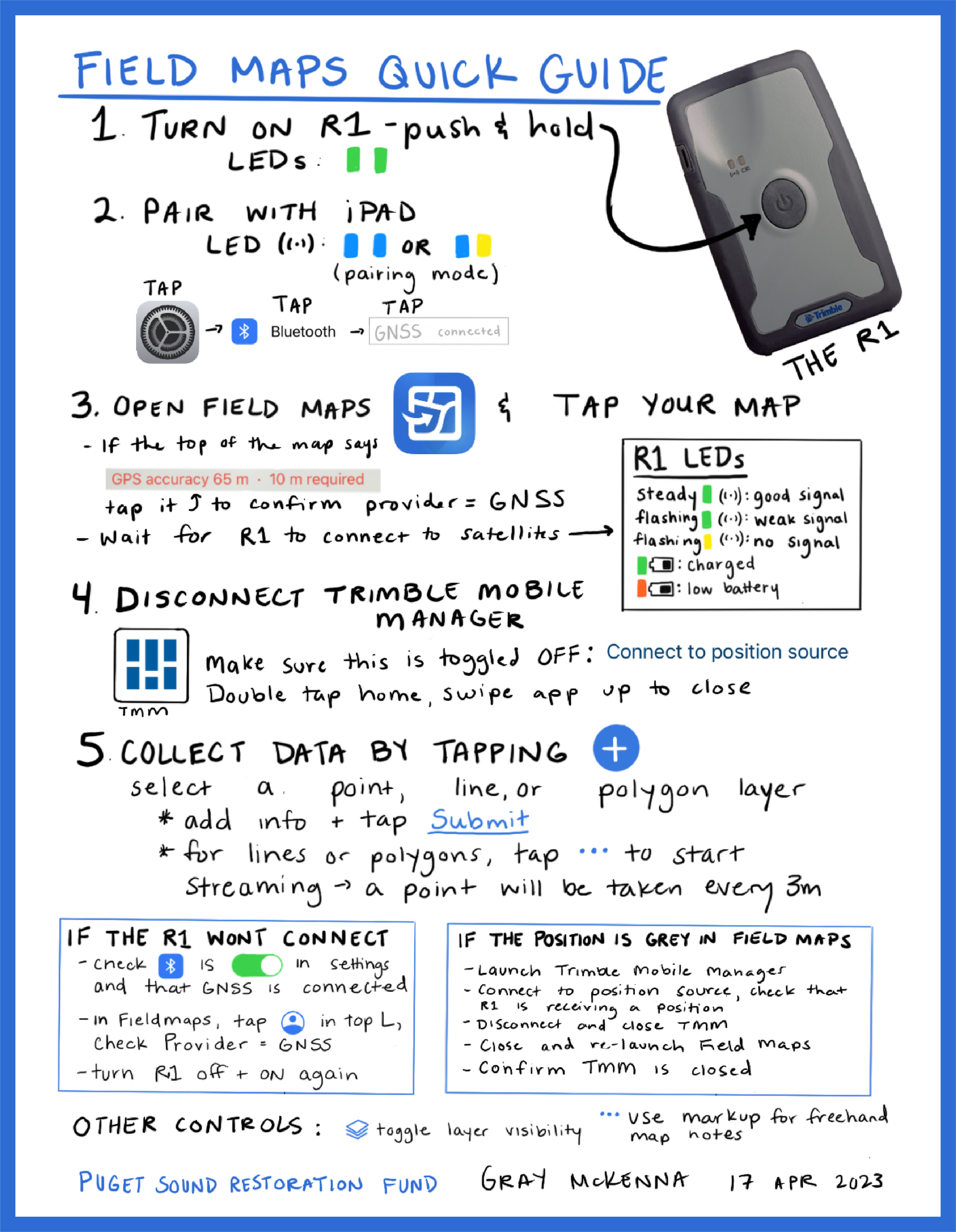
I created this simple Field Maps Quick Guide as a resource to help our field team start up and troubleshoot our high-accuracy data collection system.
I set up our initial system of an R1 reciever and iPad for our team to collect field observations on remote beaches and coastlines. We keep a laminated copy of this guide in our field gear tote, and the team often references it to troubleshoot some of the common issues we run into.